02 Feb An interactive digital globe of languages
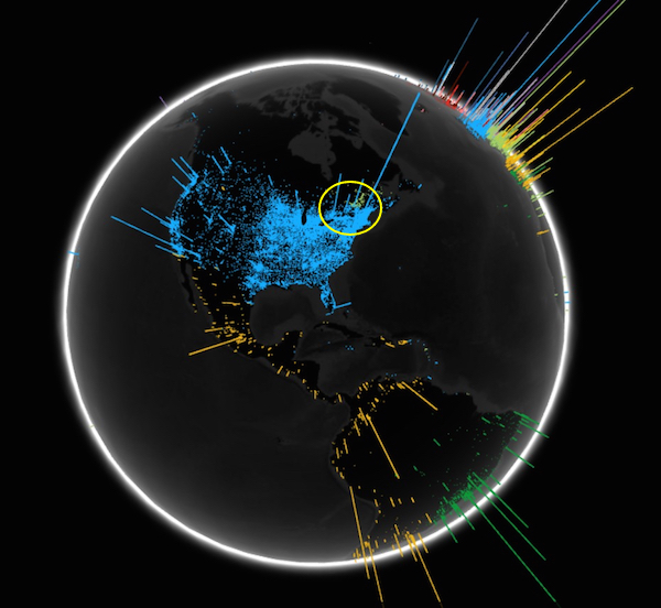
Wonder why Quebec feels linguistically isolated? The faint blush of pale green, circled on the map above, represents the French-speaking region of North America on this screenshot of an interactive Google Chrome map of the globe. Blue represents English speakers, Orange Spanish, dark green Portuguese. Polyglot Europe stands off to the northeast.
(Why there’s a barely visible orange dot near the Alberta-Montana border is beyond me.)
The example above is from an open Google-devised platform for geographic data visualization project called The WebGL Globe. It’s only a screenshot. To get the full effect, go to the source. Google encourages users to copy the code, add their own data, and create more interactive global maps. Here’s one for population.
H/T: Steve Manley