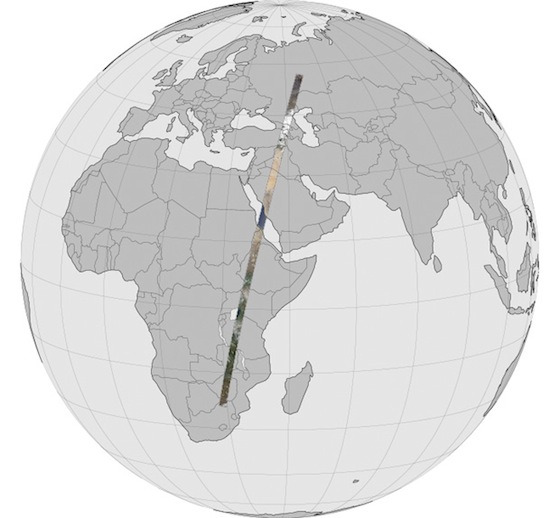
20 May A 6,000-mile long photograph
It’s 6,000 miles long and 120 miles wide (185 x 9,000 km.). It stretches from the ice-bound Kama River in Russia’s Tartaristan Province to Limpopo Province at the northern border of South Africa. It’s an unusually long stretch of unbroken land, given that water covers 70 percent of the Earth’s surface.
The Landsat Data Continuity Mission satellite, soon to be renamed Landsat 8, captured the image from an altitude of 438 miles (705 km.) by assembling 56 photographs taken over a 20-minute period on April 19 into a seamless unit. ThE 15-minute video below traverses its entire length. Be sure to view it in full screen mode by clicking the [ ] full screen icon at the lower right corner of the video, and at the highest resolution your monitor will accommodate by clicking the gear icon and selecting 1080p.
Others ways to view “The Long Swath” include:
- A four-minute compressed version, complete with labels and cheesy musical soundtrack. [Again, use full screen and hi-res.]
- An interactive display using the amazing Gigapan viewer.
More information here, here. and here. H/T: Digg.com.